Catchment Swale Dynamics
By transitioning from high-velocity stormwater shedding to low-energy on-contour infiltration, private estates become autonomous sponge terrains capable of replenishing unconfined aquifers.
The Geometry of On-Contour Hydrologic Interception
Every parcel of land features micro-elevations dictating the flow path of unmanaged precipitation. When heavy squalls strike compacted subsoils or hardscapes, water rushes down gradient vectors, gathering sediment velocity and stripping high-value microbial topsoil.
Contour swales halt this destructive cascade. A swale is an engineered ditch excavated precisely level across an elevation contour, paired with a downstream berm formed from uncompacted organic spoils. Rather than funneling water off the premises, the basin traps surface runoffs and holds them in a level hydrostatic sheet.
Under hydrostatic pressure, trapped moisture cannot accelerate. It percolates vertically through the porous gravel-loam interface, entering the deep subterranean soil profile over a controlled 24- to 48-hour infiltration window.
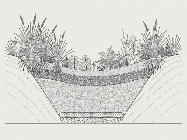
Structural Anatomy of a High-Capacity Infiltration Trench
A resilient catchment cell comprises four strictly sequenced structural horizons:
Agronomic Sizing Standard: The 2-Inch Rule
For every 1,000 square feet of upstream impervious catchment (roof, asphalt driveway, or flagstone patio), design the swale void capacity to store at least 1,250 gallons (167 cubic feet) of active runoff. This ensures zero discharge during intense localized downpours.